
walking routes
The area around Llanafan offers mixed terrain with local walks in hills and forests suitable for all abilities.
Black Covert Walks

Just 9 miles south east of Aberystwyth, and less than 2 miles from our accommodation.
Black Covert woodlands is a peaceful spot on the banks of the River Ystwyth which flows through this steep-sided valley meandering its way to Aberystwyth. Black Covert got its name from the Trawsgoed (Crosswood) Estate it was once part of and ‘covert’ is an area for raising game, probably pheasants that were once raised in the area.
For more information please visit the Natural Resources website.
Picnic Estate
The Black Covert picnic site shelters under large Ash, Birch, and Sweet chestnut trees with the beautiful Afon Ystwyth rushing by. You can choose to do the gentle riverside walk alongside of the crystal clear water, or try the more strenuous Birchgrove/Coed Alltfedw walk.
Riverside Walk
This trail offers a gentle walk through beech woodland from the picnic site and alongside the River Ystwyth returning through woodland filled with the scent of resin. In the spring the area is carpeted with bluebells.
Birchgrove Walk
This trail includes numerous long climbs and steep descents as it passes an attractive pond and the 2000 year old hill fort of Allt-Fedw. There is a viewpoint with panoramic views over rolling hills and valleys.
Directions to Black Covert: The woodland is 9 miles south-eats of Aberystwyth off the B4340 from Aberystwyth to Trawsgoed. Black Covert picnic site is 1 kilometre south of Abermagwr. Turn right over the bridge (signed Llanilar B4575) then turn immediately left and left again into the car park.
HAFOD ESTATE

A 15 minute drive away is the Hafod estate where there are great options for some more structured walking. There are 5 waymarked walks ranging from 1-4 miles in length. Walks are routed around the grounds of a former mansion and feature a range of vistas overlooking hills, forests, streams and waterfalls. The river Ystwyth runs through the estate and several of the walks cross it via bridges. Other highlights include the Cavern Cascade, a cave leading to a waterfall, and Mariamne’s Garden. There is an historic church situated next to the car park and walking maps are available.
For further details visit: www.hafod.org
SNOWDONIA NATIONAL PARK

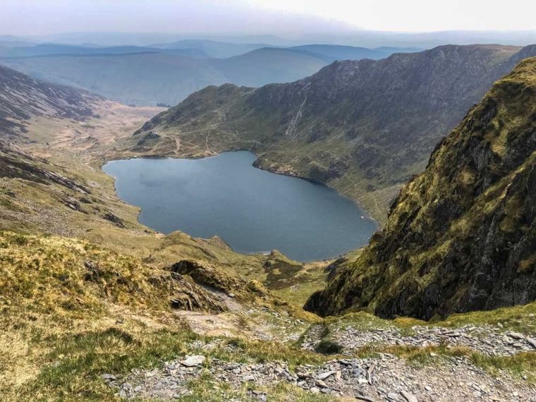
If you have an appetite for something more strenuous, the Snowdonia national park is only a short drive away. An hour’s drive will bring you to the Dôl Idris Car Park from where you can climb Cadair Idris, southern Snowdonia’s highest peak, at 893m. Cadair is a proper mountain and as such it’s always worth checking the weather together with daylight times in early and late season.
The main climbing route is via the circular Minffordd path which can be done in either a clockwise or anti-clockwise direction. It’s a source of some debate which is better but scenic vistas are ensured either way (except when it’s misty!). The path climbs high above an ancient lake, itself at around 450m altitude. The clockwise route takes in the lake first so this can be a preferable option if you are uncertain of doing the whole route. Walking to the lake and back is still a significant endeavour. Regardless of season, the lake water is always of a ‘fresh’ temperature and taking a dip remains an option for braver visitors. Take some layers though…
Further info to help plan your visit to Cadair can be found on the Natural Resources website
NATURE RESERVES
Ynyslas, near Borth. check out Natural Resources for more information.
Cors Caron, near Tregaron, check out Natural Resources for more information.
Ynys Hir, near Machynlleth, visit RSPB for more information on this nature reserve.
BEST OF THE REST

The Arch
The Arch is a local high point overlooking Devils Bridge and the Rheidol Valley
Visit Natural Resources for more information.
Devils Bridge
Devils Bridge offers unique walks which overlook its famous waterfalls, visit Devils Bridge Falls
Wales Coastal Path
The Wales coastal path is varied and photogenic on a clear day. For details see Wales Coastal Path for more information.
The Elan Valley
The Elan Valley is also nearby and offers a range of walks for diffing abilities. Elan Valley
Rheidol Valley
There are some good walks in and around the Rheidol Valley. For a different perspective, why not combine these with a trip on the Vale of Rheidol railway where some of its intermediate stations can provide unique starting points.
There are some useful leaflets here Rheidol Railway
Bwlch Nant Yr Arian
Bwlch Nant Yr Arian offers mixed routes including some dedicated to walking. Visit Natural Resources for more information.
Hafren Forest
A little further afield there is Hafren Forest, visit Natural Resources for more information.